


.svg)


.svg)


Public CEO Letter: New Year 2024
I always like letting the Regrid team's work speak for itself, so let me start this new year letter with a team photo from our 2023 retreat in Phoenix.
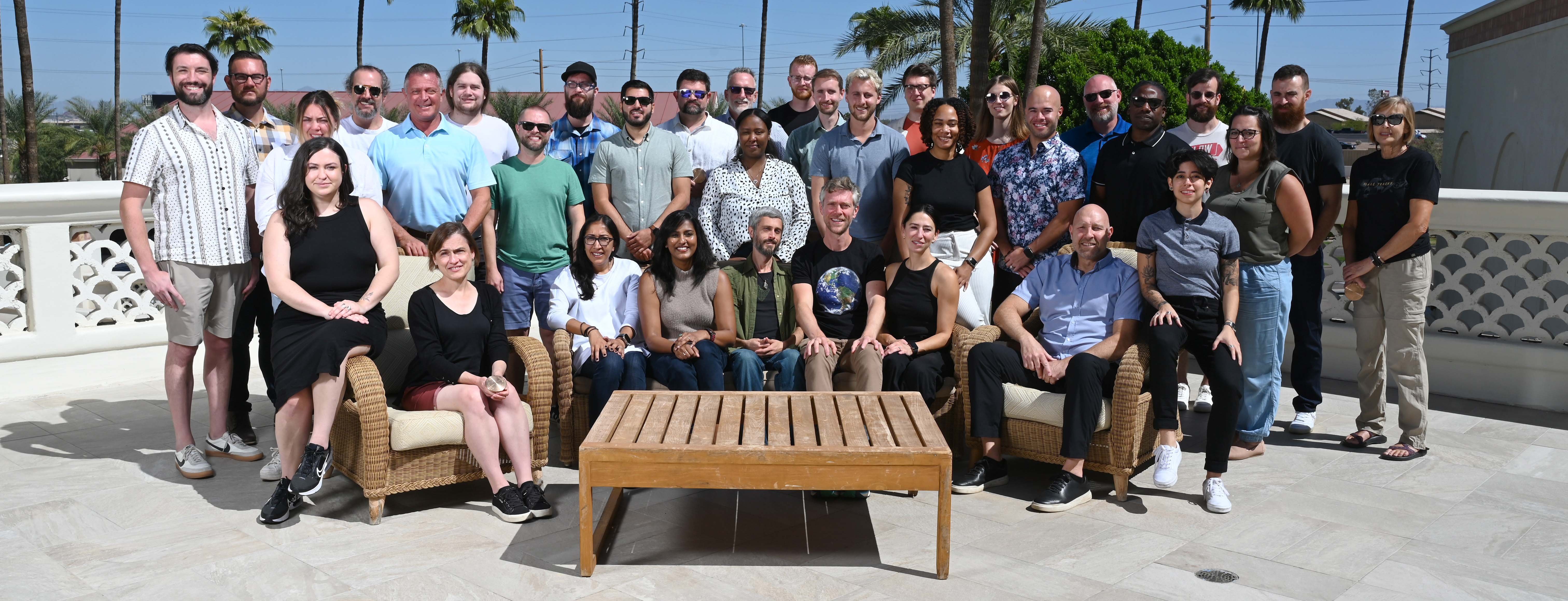
I’m seated towards the middle with the world on my chest, surrounded by the talent.
The retreat was perfectly timed for us to celebrate our most historic accomplishment of 2023: becoming the first team to ever provide a 100% land parcel coverage map of the United States. We even had a Regrid 100% parcel coverage cake, which I had the distinct pleasure of designing in Photoshop.
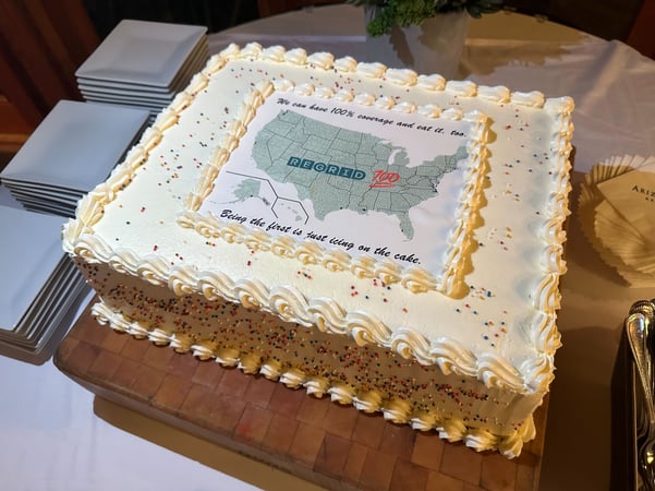
“We can have 100% coverage and eat it, too. Being the forest is just icing on the cake.”
But let me back up. My intention in this letter is to speak with you just like I speak with the team as we enter the new year, so you can see what we’re about without too much of an "outside world" filter.
I'll start with what doesn’t change from year to year at Regrid, then 10 Highlights from 2023, and 4 strategic focus areas for the new year. For those who already know us, I hope this expands your understanding of who we are, and for those who don't, welcome.
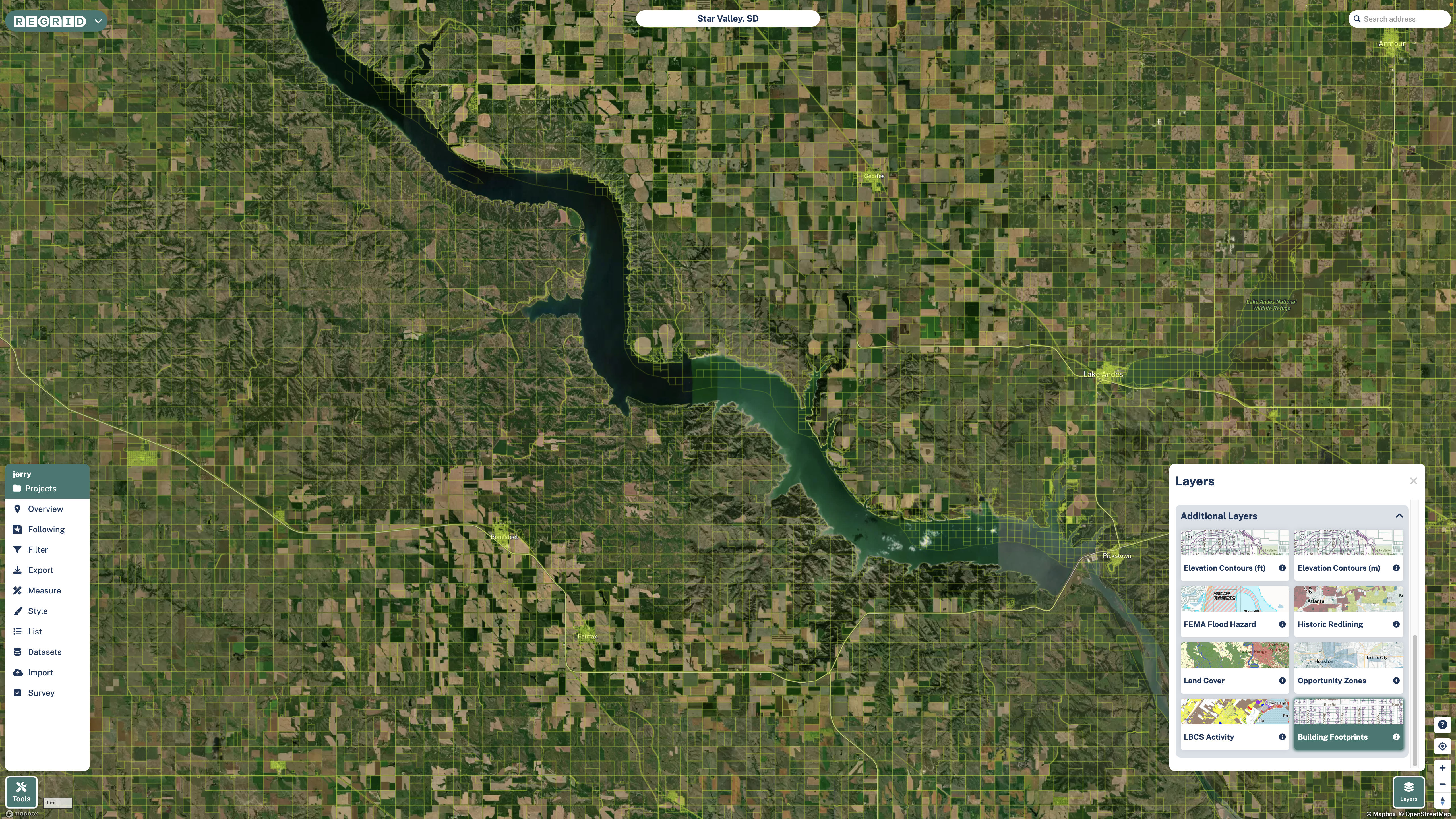
A screenshot from the Regrid Property App which also serves as an evaluation tool for all our data.
Everything we do at Regrid is focused on a single goal: to help you understand land, property, and location.
Since we all live in a property, on land, and go places, we believe our land parcel dataset is meaningful to everyone. It belongs in the hands of every person, and in the data stack of every organization that requires maps to do their work.
Before we created Regrid, we personally experienced the challenge of accessing high quality land parcel data, which makes us extremely motivated to end that challenge for everyone.
In 2023 we completed the first-ever 100% land parcel coverage map of the US. That’s not just a huge industry milestone, it’s a huge American milestone for understanding the country.
When painting a picture of scale, numbers can be helpful, but they also tend to make your mind go blank. For example, you'll agree it doesn't mean much when I say that Regrid provides:
- 157+ million property boundaries
- 186+ million building footprints
- 176+ million addresses
It may be more helpful to think of it this way:
Throw a dart at a map of the United States, and no matter where it lands, Regrid will have and maintain data for that exact spot: property boundary, building footprint, address, owner, and other datasets matched by the Regrid location ID. It doesn’t matter whether the dart hits Alaska or Manhattan.
Beyond the scale of the dataset, the operational scale is impressive, with Regrid data now powering services that millions of Americans rely on every day across energy, telecommunication, real estate, logistics, and many other markets.
We’re only 40 people, but we’re no small operation.
Because the Regrid dataset is foundational, our audience crosses categories and industries, and we embrace this.
We serve a popular audience with the Regrid Property App; companies of all sizes with our licensed data products, and nonprofits and academia through our Data With Purpose program.
Our focus on accessibility drives our dual mission:
- Be the household name for land parcel data.
- Be the leading provider of land parcel data for the enterprise.
We believe the most consequential and beloved data resource will do both, and we learn and improve so much from the diversity of customer geographies and motivations.
Sometimes people are surprised to hear we’ve reached the top of our data category while being an independent business run by people who value accessibility, collaboration, and public benefit, but that’s actually our strength.
It’s not a secret. You can tell everyone.
It keeps us confidently focused on the long term while remaining approachable, adaptable, curious, and future-ready.
Building on the things that don't change at Regrid, here are 10 accomplishments from 2023 that the team is very proud to celebrate and expand on in the new year.
| 1. | We became the first team to ever deliver a 100% US land parcel coverage map – you can see stories about the journey, significance, and future of the dataset at regrid.com/100. |
| 2. | The Regrid Property App saw tremendous updates to speed, beauty, and user experience in both the mobile and web versions – make sure to check them out. |
| 3. | The Regrid API got even better and easier to jump into, including a self-serve sandbox for developers. |
| 4. | The Regrid Feature Service for streaming data into Esri software became one of our most popular delivery methods, and we’ve deepened our partnership with Esri. |
| 5. | We launched a daily ownership changes product in partnership with ATTOM Data, and partnered with Zoneomics to provide a standardized zoning data product matched to land parcels. |
| 6. | We advanced internal Artificial Intelligence, Machine Learning, and Large Language Model projects to understand how we can appropriately use them in upcoming data products. |
| 7. | Our data Currency, Coverage, and Completeness all improved and keep improving. |
| 8. | We launched a new customer success initiative for our data licensing customers. |
| 9. | We donated more than $150,000 to nonprofits working on land, housing, and environmental issues. |
| 10. | We served 45 new nonprofits and academic clients through our Data With Purpose program, passing on a savings of $2.1 Million to public benefit projects. |
For 2024, I presented the team with 4 strategic focus areas to help guide our detailed product and data roadmaps.
I used the analogy of “reminder bands” – those bracelets with messages that help remind you of something meaningful.

If you look down at your reminder band and realize what you’re working on doesn’t connect to one of these things, or if you haven’t thought about them in a while, take a beat, and get back on track to what’s important.
|
1. More of the same, better
This means that as we do new things we will build on our existing strengths to serve our customers and improve our core products and processes. We will not get distracted by the flash and dazzle of the world. |
|
2. Education & stories
People need data for analysis and decisions, but for data to be really effective and exciting it needs to be transformed into education and stories that people can understand, remember, and explain to others. Expect more of this. |
|
3. Data creation
In addition to collecting and standardizing data, and partnering for data, we’re going to do more of our own data creation. Much of our AI and ML work is pointed in this direction: new insights that can’t be collected because they don’t yet exist. We are open to talent and collaborations in this area. |
|
4. Geographic expansion
While we’re not rushing to expand internationally, we’re beginning to lay the groundwork to present land, property, and location data everywhere on the globe. My general rule with geographic expansion outside of the US is to go where we’re invited. Now accepting inquiries. |
If our data and approach makes sense to you – and, quite possibly, feels like a breath of fresh air – you’re invited to reach out to our friendly team of data experts at regrid.com/contact.
Regrid is here for the long term, following a unique vision, and we want you here with us, putting the data to use right now, and enjoying how it continues getting better over time.
Thank you for reading, watching, and/or listening, and Happy 2024!
– Regrid CEO, Jerry Paffendorf on behalf of The Regrid Team
