×
Parcel Data on Demand - Regrid is Esri's Commercial Partner for Parcel Data
Regrid logo, registered trademark
Link
  • Enterprise

    Regrid parcel data Regrid Parcel Data

    Bulk files delivered in the format your business needs.

    • parcel -data United States Parcel Data
    • canada_nav-menu-icon Canada Parcel Data
    • matched building footprints menu icon Matched Building Footprints
    • matched secondary addresses menu icon Matched Secondary Addresses
    • zoning Standardized Zoning
    • enhanced ownership menu icon Enhanced Ownership

    feature service menu icon Regrid Feature Service

    Get data delivery straight into your Esri-stack, no custom integration required.

    regrid api menu icon Regrid API

    Integrate parcel boundaries & records into your app, SaaS, or map.
    • Parcel and Tiles APIcon Parcel & Tiles API
  • Self Serve

    Regrid Property App menu icon Regrid Property App

    Take Regrid property data wherever you go - available for web, iOS, & Android.

    data-store-2 Shop the Data Store

    Instantly download parcel geometries & associated records, by county and state.

    self-serve parcel api menu icon API Monthly Subscriptions

    Sign up and try this nationwide parcel API, free for 7 days.

    api sandbox icon Interactive API Sandbox

    Explore the API Sandbox with complete feature access to 7 counties plus Puerto Rico.
  • Pricing
  • Markets

    agr-con-for_menu-icon-1 Agriculture, Conservation & Forestry

    Regrid for Architecture, Engineering & Construction Architecture, Engineering & Construction

    Esri environments Esri Users

    Regrid for Broadband and Telecommunication Broadband & Telecommunications

    Regrid for Renewable Energy & Utilities Renewable Energy & Utilities

    Regrid for Logistics & Transportation Logistics & Transportation

    Regrid for State & Federal Government State & Federal Government

    Regrid for Insurance & Finance Insurance & Finance

    Regrid for AI & Machine Learning AI & Machine Learning

    Regrid for Real Estate Real Estate

    Regrid for Academia and Research Nonprofit & Academia

    Regrid's Data With Purpose program - propose your own budget to access land parcel data. 

    Plus sign icon Your Business or Organization

    Regrid’s data spans all industries needing land insight.
  • Resources

    support menu icon Support

    Access documentation & support materials to learn about Regrid data.
    • Support site resource icon Support Site
    • tutorial videos resources icon Tutorial Videos
    • parcel data faqs resources icon Parcel Data FAQs
    • property app faqs Property App FAQs
    • coveragemap_resources_icon Coverage Map
    • land use codes menu item Land Use Codes
    • vacancy data menu icon Vacancy Data
    • Data Currency Data Currency FAQs

    content resources menu icon Content

    Dive into Regrid's world of land parcels & learn about location intelligence.
    • blog resources icon Blog
    • webcasts resources icon Webcasts
    • reports resources icon Reports
    • podcast resources icon Living In The Map

    customers resources icon Customers

    Hear what our customers say have to say & see how they use Regrid data.
    • testimonials resources icon Testimonials
    • Case Studies resources icon Case Studies
  • Contact Us

    Contact a parcel data expert menu icon Contact A Parcel Data Expert

    Contact Regrid parcel data experts to learn more about our offerings.

    Customer Support menu icon Customer Support

    Contact our customer support team & get the help you need.

    testimonials_resources_icon-1 Press & Media Inquires

    Find the information you need & get in touch with our marketing department.
  • Go To Map
Go To Map
  • Enterprise

    Regrid Parcel Data

    • United States Parcel Data
    • Canada Parcel Data
    • Matched Building Footprints
    • Matched Secondary Addresses
    • Standardized Zoning
    • Enhanced Ownership

    Regrid Feature Service

    Regrid API

    • Parcel & Tiles API
  • Self Serve

    Regrid Property App

    Shop the Data Store

    API Monthly Subscriptions

    Interactive API Sandbox

  • Pricing
  • Markets

    Agriculture, Conservation & Forestry

    Architecture, Engineering & Construction

    Esri Users

    Broadband & Telecommunications

    Renewable Energy & Utilities

    Logistics & Transportation

    State & Federal Government

    Insurance & Finance

    AI & Machine Learning

    Real Estate

    Nonprofit & Academia

    Your Business or Organization

  • Resources

    Support

    • Support Site
    • Tutorial Videos
    • Parcel Data FAQs
    • Property App FAQs
    • Coverage Map
    • Land Use Codes
    • Vacancy Data
    • Data Currency FAQs

    Content

    • Blog
    • Webcasts
    • Reports
    • Living In The Map

    Customers

    • Testimonials
    • Case Studies
  • Contact Us

    Contact A Parcel Data Expert

    Customer Support

    Press & Media Inquires

    Link

  • Go To Map

Parcel Data on Demand
for The Esri Ecosystem

Regrid is Esri's Commercial Partner for Parcel Data
Access to Parcel Data for Esri Users

Regrid and Esri have partnered to solve parcel data for the Esri Community. Nationwide parcel boundaries for the entire United States are a click away in ArcGIS Living Atlas of the World. Through a seamless connection to the Regrid Datastore, Esri users can purchase county and state boundaries with premium attributes.

ESRIgold (1)

Access Nationwide Parcels in the ArcGIS Living Atlas

Free! View the raster tile layer in the ArcGIS Living Atlas of the World, which showcases our nationwide parcel boundaries and a limited set of attributes. This view-only parcel tile layer includes a subset of attributes for all 158 million parcels comprising the United States, including parcel ID, situs address and parcel size. You are now fully empowered to include the parcel perspective into all of your ArcGIS maps with the push of a button.

Visit the ArcGIS Living Atlas

Buy & Instantly Download County & Statewide Data

Get instant access to Regrid's parcel data attributes and boundaries by county and state, as well as our add-on datasets like standardized zoning, matched building footprints, and matched secondary addresses. All this data is seamlessly matched to parcels and ready to open in ArcGIS. In a few clicks, you are now fully empowered to incorporate parcels into your work.
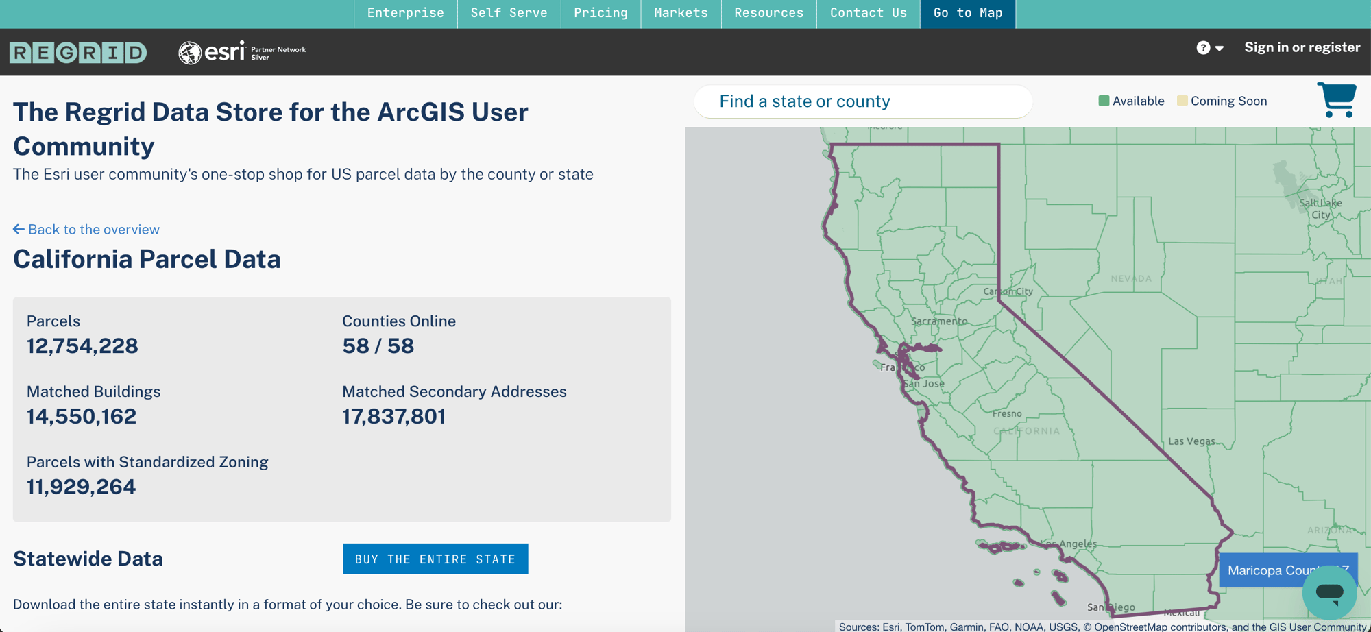
Shop Regrid's Data Store for Esri Users
Cobranded Regrid Data Store

Regrid Feature Service for All Attributes & Updates

The Regrid Feature Service is your enterprise-grade solution for spatial parcel data with all attributes, add-ons, and updates. It is designed for organizations who need deep and ongoing insights into land and property across the country.

Why Get Regrid Nationwide Parcel Data Delivered via Feature Service?

      • Esri-Compatible: Use with ArcGIS Pro desktop, application configuration tools hosted on ArcGIS Online, and Arc SDKs.
      • Simple URL Integration: No custom integration, no data wrangling.
      • Fast, Efficient Environment: Navigate nationwide parcel data with ease.
      • Hosted by Regrid: Avoid those expensive data storage fees, we host all our own data.
Learn More About Regrid's Feature Service

Regrid Parcels + Esri Technology = Incredible Insights

Watch Esri Senior Solutions Engineer, Jess Altamira, use Regrid's parcel data and Esri's Big Data Toolkit to demonstrate lightning fast parcel site selection at national scale: finding the perfect parcels out of all 158 million based on specific attributes and proximity requirements.

Whether you're simply overlaying parcel boundaries on a map, filtering for parcel attributes, joining parcels to other map layers, or doing deeper technological integrations like what is highlighted in the video.  Regrid's parcel data stands ready to bring your geographic analysis to the next level anywhere in the Esri ecosystem. 

Our Diverse Data Customers Love Us & Vice Versa

Regrid is proud to serve organizations of all sizes in all industries,
from the Fortune 500 to startups, government, nonprofits, and academia.

Ford
GP-logo
verisk-logo
epaus-logo
2560px-Alliant_Energy_logo.svg
1280px-W._W._Grainger_logo.svg
Anywhere-RealEstate_Logo
CREXi logo
Integral Analytics logo
betterview_logo
blackandveatch
lemonade logo
Connectbase_Logo
Replica_Logos_MasterFile_Logo_Primary_Large_Black-1
giraffe-logo

Start Your Journey To Better Maps & Land Insight

Join the community of GIS professionals already leveraging Regrid and Esri's power to achieve outstanding results. Our team is ready to help you get the most out of the nationwide parcel data set we provide to empower your business, organization and/or mapping needs.
 
Together, we can transform how you work with property data and help you achieve your project goals confidently and easily. Let's make amazing things happen!
 
Start by completing this form to speak with a Regrid parcel data expert. 
logo

(888) 4RE-GRID

  • Contact Us
  • Customer Support
  • Privacy Policy
  • Terms of Use

Subscribe for email updates

Company

  • About Regrid
  • Careers
  • Press

Resources

  • Coverage Map
  • Support Center
  • Reports

Support

  • Parcel Data FAQs
  • Property App FAQs
  • Contact Support Team

Customers

  • Customer Stories
  • Case Studies
  • Non Profit & Academia

Enterprise Solutions

  • Nationwide Land Parcels
  • Parcel & Tiles API
  • Feature Service

Self-Serve Solutions

  • Regrid Property App
  • Shop the Data Store
  • API Monthly Plans