×
Parcel Data on Demand - Regrid is Esri's Commercial Partner for Parcel Data
Regrid logo, registered trademark
Link
  • Enterprise

    Regrid parcel data Regrid Parcel Data

    Bulk files delivered in the format your business needs.

    • parcel -data United States Parcel Data
    • canada_nav-menu-icon Canada Parcel Data
    • matched building footprints menu icon Matched Building Footprints
    • matched secondary addresses menu icon Matched Secondary Addresses
    • zoning Standardized Zoning
    • enhanced ownership menu icon Enhanced Ownership

    feature service menu icon Regrid Feature Service

    Get data delivery straight into your Esri-stack, no custom integration required.

    regrid api menu icon Regrid API

    Integrate parcel boundaries & records into your app, SaaS, or map.
    • Parcel and Tiles APIcon Parcel & Tiles API
  • Self Serve

    Regrid Property App menu icon Regrid Property App

    Take Regrid property data wherever you go - available for web, iOS, & Android.

    data-store-2 Shop the Data Store

    Instantly download parcel geometries & associated records, by county and state.

    self-serve parcel api menu icon API Monthly Subscriptions

    Sign up and try this nationwide parcel API, free for 7 days.

    api sandbox icon Interactive API Sandbox

    Explore the API Sandbox with complete feature access to 7 counties plus Puerto Rico.
  • Pricing
  • Markets

    agr-con-for_menu-icon-1 Agriculture, Conservation & Forestry

    Regrid for Architecture, Engineering & Construction Architecture, Engineering & Construction

    Esri environments Esri Users

    Regrid for Broadband and Telecommunication Broadband & Telecommunications

    Regrid for Renewable Energy & Utilities Renewable Energy & Utilities

    Regrid for Logistics & Transportation Logistics & Transportation

    Regrid for State & Federal Government State & Federal Government

    Regrid for Insurance & Finance Insurance & Finance

    Regrid for AI & Machine Learning AI & Machine Learning

    Regrid for Real Estate Real Estate

    Regrid for Academia and Research Nonprofit & Academia

    Regrid's Data With Purpose program - propose your own budget to access land parcel data. 

    Plus sign icon Your Business or Organization

    Regrid’s data spans all industries needing land insight.
  • Resources

    support menu icon Support

    Access documentation & support materials to learn about Regrid data.
    • Support site resource icon Support Site
    • tutorial videos resources icon Tutorial Videos
    • parcel data faqs resources icon Parcel Data FAQs
    • property app faqs Property App FAQs
    • coveragemap_resources_icon Coverage Map
    • land use codes menu item Land Use Codes
    • vacancy data menu icon Vacancy Data
    • Data Currency Data Currency FAQs

    content resources menu icon Content

    Dive into Regrid's world of land parcels & learn about location intelligence.
    • blog resources icon Blog
    • webcasts resources icon Webcasts
    • reports resources icon Reports
    • podcast resources icon Living In The Map

    customers resources icon Customers

    Hear what our customers say have to say & see how they use Regrid data.
    • testimonials resources icon Testimonials
    • Case Studies resources icon Case Studies
  • Contact Us

    Contact a parcel data expert menu icon Contact A Parcel Data Expert

    Contact Regrid parcel data experts to learn more about our offerings.

    Customer Support menu icon Customer Support

    Contact our customer support team & get the help you need.

    testimonials_resources_icon-1 Press & Media Inquires

    Find the information you need & get in touch with our marketing department.
  • Go To Map
Go To Map
  • Enterprise

    Regrid Parcel Data

    • United States Parcel Data
    • Canada Parcel Data
    • Matched Building Footprints
    • Matched Secondary Addresses
    • Standardized Zoning
    • Enhanced Ownership

    Regrid Feature Service

    Regrid API

    • Parcel & Tiles API
  • Self Serve

    Regrid Property App

    Shop the Data Store

    API Monthly Subscriptions

    Interactive API Sandbox

  • Pricing
  • Markets

    Agriculture, Conservation & Forestry

    Architecture, Engineering & Construction

    Esri Users

    Broadband & Telecommunications

    Renewable Energy & Utilities

    Logistics & Transportation

    State & Federal Government

    Insurance & Finance

    AI & Machine Learning

    Real Estate

    Nonprofit & Academia

    Your Business or Organization

  • Resources

    Support

    • Support Site
    • Tutorial Videos
    • Parcel Data FAQs
    • Property App FAQs
    • Coverage Map
    • Land Use Codes
    • Vacancy Data
    • Data Currency FAQs

    Content

    • Blog
    • Webcasts
    • Reports
    • Living In The Map

    Customers

    • Testimonials
    • Case Studies
  • Contact Us

    Contact A Parcel Data Expert

    Customer Support

    Press & Media Inquires

    Link

  • Go To Map

The Regrid Blog

Discover the Latest in Land Parcels & Spatial Data with the Regrid Team!

Regrid Blog

Living In The Map

Categories

  • Announcements
  • Democratizing Data
  • Parcel Data Updates
  • Regrid Updates
  • Product How-To
  • Use Cases
  • Customer & Guest Blogs
  • All About Parcel Data
  • Working at Regrid
  • Regrid 100
  • Reports

New single & multi user accounts, new features & new content

Sahana Murthy February 5, 2020

A parcel map from the Regrid Mapping Platform

Wow, it's February already and boy do we have some serious Landgrid platform updates for you!

1. Single User Accounts - Those of you who have been with us from the start, you know that Landgrid Pro & Free accounts are our affordable, single user accounts primarily meant to explore our nationwide parcel dataset. We have made a few updates to these accounts, recently:

  • Landgrid Free -  Free has been our flagship parcel viewer for a while, and remains that way. However, Free is now restricted to just viewing and exploring parcel records. You will not be able to query & style the data any longer. We have found that most of our Free users love to use free for just that - looking up parcel data uninterrupted and learning about properties that they care about. 
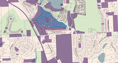
  • Landgrid Pro - Pro just got bigger and better with the recent addition of Buildings data & footprints layer which is available only for Pro & above customers. Not only can you view buildings on top of parcels now, you can also see:
    • Buildings Count - Number of buildings per parcel
    • Buildings Sq Footage - How much of a parcel is covered by a building
    • Vacant Lots - When you filter by buildings count and set Max = ‘0’ on the filter,  you will be able to see all the vacant lots in your geography.
      How cool is that!!

Apart from that, another change that we recently made was to cap the number of projects & surveys to a maximum of 5 per user. 
We found that most of our customers preferred to make 4-5 maps & surveys on average anyway. 

Rest assured, those of you who already have more than 5 projects & surveys right now that they will remain intact. You will however not be able to create new projects unless you delete an existing project.

  • Concurrent Logins -  As we have always advertised, Free and Pro are meant to be single user accounts. As a result, we recently updated our systems to allow no more than 2 concurrent logins/devices/browsers at a time per user. 

If you attempt a 3rd login, you will be asked to sign out of one of your active sessions to enable another login session.

Please let us know if you currently have multiple users logged in or multiple logins that you are not able to track and log out of. We can sign you out on our end. However, in future, please try to limit your concurrent sessions to a maximum of 2 to avoid getting signed out.


2. Multi User Accounts - While the Free & Pro accounts are designed to be single-user accounts, we also offer scalable multi-user accounts that allows multiple members of your team & projects to have their own individual login credentials to the same account:

  • Landgrid Team
  • Landgrid Enterprise

Landgrid Team is the baseline of what our enterprise accounts could do and works well for projects that need multiple users, surveyors but not a lot of custom work or requirements.

Team account also allows you to export up to 50K rows of spreadsheet data with USPS and buildings data too. 

Email us at enterprise@landgrid.com if you want an upgrade to Team, it takes us just a few seconds to set that up for you!

However, for those of you who have very specific needs for a project that cannot be solved with straight out of the box solutions, then Landgrid Enterprise is the solution for you. 
What can we do with Enterprise, you ask???

Landgrid Enterprise:

  • Custom data integration & imports - Bring your data, no matter the size,  scale & type of data and we will clean it up and import it on Landgrid so you can have all your data in 1 place!
  • Custom work, site, maps & interface - We know one size/design doesn’t fit all. Hence, we provide custom solutions to meet your needs - whether its custom filters, custom data, an entire custom site with customized embedded static & interactive maps or a white label custom interface with your own branding on it, we can make it all happen for you.
  • Insights page with custom filters - Let us help with your decision making process. What are the key data insights that you need to succeed with your project? We can set that up for you on your daily data dashboard - the Landgrid interface! Data insights and decisions will never have been easier!
  • Custom reporting - Based on those insights, we can build a custom report for you or find a way to automate those reports.
  • Watermarking surveys - For those of you who do a lot of surveys, we can watermark them by date and other specifics that you need to categorize those survey images.
  • Print maps & PDF’s - You can now print every survey & parcel page as a PDF for notarizing & also print high resolution copies of the beautiful maps for your official project reports.
  • 360 degree surveying - Collect, own and survey using your own inexpensive 360 imagery. We now have the ability to support 360 surveying which will enable you to survey properties from your desktops. Nifty huh!!!


Phew!! There’s more that we can do with Enterprise like ArcGIS compatibility or integration with Tableau or PolicyMap to name a few. Sky’s the limit and we will work with you to make it happen.
Want to know more about how we can get you the solution you need - email us at enterprise@landgrid.com!


3. New Educational Content -  In keeping with our goals for 2020, we recently added and will continue to add a slew of how-to videos and educational webinars to empower you in your daily tasks with Landgrid. Check them out when you have a moment:

Upcoming Webinars:

  1. Landgrid Data - Coverage & Accuracy (Register here - https://www.crowdcast.io/e/landgrid-data---overview)
  2. Surveying Best Practices with Landgrid Platform (Register here - https://www.crowdcast.io/e/surveying-best-practices )


Recent Videos & Webinar Videocasts:

  1. Buildings Data on Landgrid.com
  2. Landgrid Enterprise for Real Estate
  3. Troubleshooting Data Import on Landgrid.com
  4. How to use buildings data on Landgrid.com

Alright, that’s it from us for now!
We know it's a lot, so please consume this email at your leisure & as always, email us at team@landgrid.com  if you have any questions.
 

Happy Leap Year Month Folks!

Happy Mapping!

Previous Next
logo

(888) 4RE-GRID

  • Contact Us
  • Customer Support
  • Privacy Policy
  • Terms of Use

Subscribe for email updates

Company

  • About Regrid
  • Careers
  • Press

Resources

  • Coverage Map
  • Support Center
  • Reports

Support

  • Parcel Data FAQs
  • Property App FAQs
  • Contact Support Team

Customers

  • Customer Stories
  • Case Studies
  • Non Profit & Academia

Enterprise Solutions

  • Nationwide Land Parcels
  • Parcel & Tiles API
  • Feature Service

Self-Serve Solutions

  • Regrid Property App
  • Shop the Data Store
  • API Monthly Plans