×
Parcel Data on Demand - Regrid is Esri's Commercial Partner for Parcel Data
Regrid logo, registered trademark
Link
  • Enterprise

    Regrid parcel data Regrid Parcel Data

    Bulk files delivered in the format your business needs.

    • parcel -data United States Parcel Data
    • canada_nav-menu-icon Canada Parcel Data
    • matched building footprints menu icon Matched Building Footprints
    • matched secondary addresses menu icon Matched Secondary Addresses
    • zoning Standardized Zoning
    • enhanced ownership menu icon Enhanced Ownership

    feature service menu icon Regrid Feature Service

    Get data delivery straight into your Esri-stack, no custom integration required.

    regrid api menu icon Regrid API

    Integrate parcel boundaries & records into your app, SaaS, or map.
    • Parcel and Tiles APIcon Parcel & Tiles API
  • Self Serve

    Regrid Property App menu icon Regrid Property App

    Take Regrid property data wherever you go - available for web, iOS, & Android.

    data-store-2 Shop the Data Store

    Instantly download parcel geometries & associated records, by county and state.

    self-serve parcel api menu icon API Monthly Subscriptions

    Sign up and try this nationwide parcel API, free for 7 days.

    api sandbox icon Interactive API Sandbox

    Explore the API Sandbox with complete feature access to 7 counties plus Puerto Rico.
  • Pricing
  • Markets

    agr-con-for_menu-icon-1 Agriculture, Conservation & Forestry

    Regrid for Architecture, Engineering & Construction Architecture, Engineering & Construction

    Esri environments Esri Users

    Regrid for Broadband and Telecommunication Broadband & Telecommunications

    Regrid for Renewable Energy & Utilities Renewable Energy & Utilities

    Regrid for Logistics & Transportation Logistics & Transportation

    Regrid for State & Federal Government State & Federal Government

    Regrid for Insurance & Finance Insurance & Finance

    Regrid for AI & Machine Learning AI & Machine Learning

    Regrid for Real Estate Real Estate

    Regrid for Academia and Research Nonprofit & Academia

    Regrid's Data With Purpose program - propose your own budget to access land parcel data. 

    Plus sign icon Your Business or Organization

    Regrid’s data spans all industries needing land insight.
  • Resources

    support menu icon Support

    Access documentation & support materials to learn about Regrid data.
    • Support site resource icon Support Site
    • tutorial videos resources icon Tutorial Videos
    • parcel data faqs resources icon Parcel Data FAQs
    • property app faqs Property App FAQs
    • coveragemap_resources_icon Coverage Map
    • land use codes menu item Land Use Codes
    • vacancy data menu icon Vacancy Data
    • Data Currency Data Currency FAQs

    content resources menu icon Content

    Dive into Regrid's world of land parcels & learn about location intelligence.
    • blog resources icon Blog
    • webcasts resources icon Webcasts
    • reports resources icon Reports
    • podcast resources icon Living In The Map

    customers resources icon Customers

    Hear what our customers say have to say & see how they use Regrid data.
    • testimonials resources icon Testimonials
    • Case Studies resources icon Case Studies
  • Contact Us

    Contact a parcel data expert menu icon Contact A Parcel Data Expert

    Contact Regrid parcel data experts to learn more about our offerings.

    Customer Support menu icon Customer Support

    Contact our customer support team & get the help you need.

    testimonials_resources_icon-1 Press & Media Inquires

    Find the information you need & get in touch with our marketing department.
  • Go To Map
Go To Map
  • Enterprise

    Regrid Parcel Data

    • United States Parcel Data
    • Canada Parcel Data
    • Matched Building Footprints
    • Matched Secondary Addresses
    • Standardized Zoning
    • Enhanced Ownership

    Regrid Feature Service

    Regrid API

    • Parcel & Tiles API
  • Self Serve

    Regrid Property App

    Shop the Data Store

    API Monthly Subscriptions

    Interactive API Sandbox

  • Pricing
  • Markets

    Agriculture, Conservation & Forestry

    Architecture, Engineering & Construction

    Esri Users

    Broadband & Telecommunications

    Renewable Energy & Utilities

    Logistics & Transportation

    State & Federal Government

    Insurance & Finance

    AI & Machine Learning

    Real Estate

    Nonprofit & Academia

    Your Business or Organization

  • Resources

    Support

    • Support Site
    • Tutorial Videos
    • Parcel Data FAQs
    • Property App FAQs
    • Coverage Map
    • Land Use Codes
    • Vacancy Data
    • Data Currency FAQs

    Content

    • Blog
    • Webcasts
    • Reports
    • Living In The Map

    Customers

    • Testimonials
    • Case Studies
  • Contact Us

    Contact A Parcel Data Expert

    Customer Support

    Press & Media Inquires

    Link

  • Go To Map

Fast Data Delivery Results in Profound ROI

Datastory Gets The High Quality Parcel Data They Need with Regrid’s Feature Service

Overview

Adding Value to MapDash with More Data

Seeking a top-notch, nationwide parcel layer the Datastory team turned to Regrid for a solution to enhance their location intelligence app MapDash.

Datastory can now deliver precise land parcel data to their clients more effectively.

As the premier provider of land parcel data, Regrid's Esri-compatible Feature Service offers the high-quality data they require in the perfect format.

Challenge

Solving For Parcel Data

Before leveraging Regrid, Datastory relied on individual project negotiation, limiting its ability to scale. Because many of their clients are small-to-midsized organizations, licensing parcel data was not fiscally feasible for them.

Approach

Regrid's Esri-compatible Feature Service

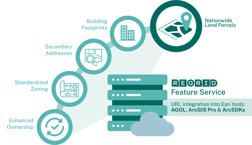
The Regrid Feature Service is the bridge that connects you to nationwide parcel data.

It's built for explorers in the realm of GIS, urban planners navigating the concrete jungles, real estate professionals expanding to new territories, and countless other Esri-based organizations who need to unlock deeper insights from land.

Learn More About Regrid's Feature Service

Solution

Building A Scalable Model of Parcel Delivery

The Regrid Feature Service has provided Datastory with the high-quality parcel data they need in the right format. Working with the Regrid sales team, they were able to create a scalable business model that allows them to begin by delivering parcel information and grow into larger opportunities.

Now they can on-ramp clients more quickly and grow their appetite for more data from Regrid and more services from Datastory.
Feature-Service-w-Zoning_graphic

"High quality data AND in the right format" 

Matt Felton
Founder

ROI

Fast & Easy Data Delivery

The most profound return on investment has been the ability to quickly deliver parcel data to Datastory clients as context for demographic analysis, and in some instances, more robust spatial data science. Previously, deal had to be negotatiated on a case-by-case basis.

Datastory clients appreciate having reliable and complete coverage of parcels to provide context for their location analysis in MapDash. Several Datastory clients have also upgraded to a more premium data feed from Regrid.

Datastory logo


Industry
Location Intelligence

About the Company
Datastory offers a wide array of expert services that back MapDash, their all-in-one solution for gaining valuable business insights through GIS technology

Website
datastoryli.com


Challenge

Providing accurate parcel data to clients at the right fit price.

Approach
Parcel data delivered via Regrid's compatible Feature Service.

Solution
Building a scalable model of parcel delivery.

Fuel Your Business With Fresh, Accurate Parcel Data

Experience The Land Parcel Insight Powered by Regrid’s 3Cs

parcel -data Coverage: Nationwide & Local Insight
Regrid’s parcel coverage spans across every city, county, and state. Explore the insights waiting for you in every corner of the country, including your own street. 

enhanced-ownership-1 Currency: Always Fresh Land Parcel Data

Get the edge of fresh land data precision. Regrid’s parcel data is continuously refreshed, guaranteeing that you have the latest and most dependable nationwide land parcel data. 

parcel-api (1) Completeness: Parcel Boundaries & More!

Explore comprehensive data on land, ownership, buildings, and other related information. Acquire all the pertinent details on each parcel to enable you to make informed decisions.

Get the 3Cs and more when you complete the form next door.

Go for it!

logo

(888) 4RE-GRID

  • Contact Us
  • Customer Support
  • Privacy Policy
  • Terms of Use

Subscribe for email updates

Company

  • About Regrid
  • Careers
  • Press

Resources

  • Coverage Map
  • Support Center
  • Reports

Support

  • Parcel Data FAQs
  • Property App FAQs
  • Contact Support Team

Customers

  • Customer Stories
  • Case Studies
  • Non Profit & Academia

Enterprise Solutions

  • Nationwide Land Parcels
  • Parcel & Tiles API
  • Feature Service

Self-Serve Solutions

  • Regrid Property App
  • Shop the Data Store
  • API Monthly Plans