×
Parcel Data on Demand - Regrid is Esri's Commercial Partner for Parcel Data
Regrid logo, registered trademark
Link
  • Enterprise

    Regrid parcel data Regrid Parcel Data

    Bulk files delivered in the format your business needs.

    • parcel -data United States Parcel Data
    • canada_nav-menu-icon Canada Parcel Data
    • matched building footprints menu icon Matched Building Footprints
    • matched secondary addresses menu icon Matched Secondary Addresses
    • zoning Standardized Zoning
    • enhanced ownership menu icon Enhanced Ownership

    feature service menu icon Regrid Feature Service

    Get data delivery straight into your Esri-stack, no custom integration required.

    regrid api menu icon Regrid API

    Integrate parcel boundaries & records into your app, SaaS, or map.
    • Parcel and Tiles APIcon Parcel & Tiles API
  • Self Serve

    Regrid Property App menu icon Regrid Property App

    Take Regrid property data wherever you go - available for web, iOS, & Android.

    data-store-2 Shop the Data Store

    Instantly download parcel geometries & associated records, by county and state.

    self-serve parcel api menu icon API Monthly Subscriptions

    Sign up and try this nationwide parcel API, free for 7 days.

    api sandbox icon Interactive API Sandbox

    Explore the API Sandbox with complete feature access to 7 counties plus Puerto Rico.
  • Pricing
  • Markets

    agr-con-for_menu-icon-1 Agriculture, Conservation & Forestry

    Regrid for Architecture, Engineering & Construction Architecture, Engineering & Construction

    Esri environments Esri Users

    Regrid for Broadband and Telecommunication Broadband & Telecommunications

    Regrid for Renewable Energy & Utilities Renewable Energy & Utilities

    Regrid for Logistics & Transportation Logistics & Transportation

    Regrid for State & Federal Government State & Federal Government

    Regrid for Insurance & Finance Insurance & Finance

    Regrid for AI & Machine Learning AI & Machine Learning

    Regrid for Real Estate Real Estate

    Regrid for Academia and Research Nonprofit & Academia

    Regrid's Data With Purpose program - propose your own budget to access land parcel data. 

    Plus sign icon Your Business or Organization

    Regrid’s data spans all industries needing land insight.
  • Resources

    support menu icon Support

    Access documentation & support materials to learn about Regrid data.
    • Support site resource icon Support Site
    • tutorial videos resources icon Tutorial Videos
    • parcel data faqs resources icon Parcel Data FAQs
    • property app faqs Property App FAQs
    • coveragemap_resources_icon Coverage Map
    • land use codes menu item Land Use Codes
    • vacancy data menu icon Vacancy Data
    • Data Currency Data Currency FAQs

    content resources menu icon Content

    Dive into Regrid's world of land parcels & learn about location intelligence.
    • blog resources icon Blog
    • webcasts resources icon Webcasts
    • reports resources icon Reports
    • podcast resources icon Living In The Map

    customers resources icon Customers

    Hear what our customers say have to say & see how they use Regrid data.
    • testimonials resources icon Testimonials
    • Case Studies resources icon Case Studies
  • Contact Us

    Contact a parcel data expert menu icon Contact A Parcel Data Expert

    Contact Regrid parcel data experts to learn more about our offerings.

    Customer Support menu icon Customer Support

    Contact our customer support team & get the help you need.

    testimonials_resources_icon-1 Press & Media Inquires

    Find the information you need & get in touch with our marketing department.
  • Go To Map
Go To Map
  • Enterprise

    Regrid Parcel Data

    • United States Parcel Data
    • Canada Parcel Data
    • Matched Building Footprints
    • Matched Secondary Addresses
    • Standardized Zoning
    • Enhanced Ownership

    Regrid Feature Service

    Regrid API

    • Parcel & Tiles API
  • Self Serve

    Regrid Property App

    Shop the Data Store

    API Monthly Subscriptions

    Interactive API Sandbox

  • Pricing
  • Markets

    Agriculture, Conservation & Forestry

    Architecture, Engineering & Construction

    Esri Users

    Broadband & Telecommunications

    Renewable Energy & Utilities

    Logistics & Transportation

    State & Federal Government

    Insurance & Finance

    AI & Machine Learning

    Real Estate

    Nonprofit & Academia

    Your Business or Organization

  • Resources

    Support

    • Support Site
    • Tutorial Videos
    • Parcel Data FAQs
    • Property App FAQs
    • Coverage Map
    • Land Use Codes
    • Vacancy Data
    • Data Currency FAQs

    Content

    • Blog
    • Webcasts
    • Reports
    • Living In The Map

    Customers

    • Testimonials
    • Case Studies
  • Contact Us

    Contact A Parcel Data Expert

    Customer Support

    Press & Media Inquires

    Link

  • Go To Map

The Regrid Blog

Discover the Latest in Land Parcels & Spatial Data with the Regrid Team!

Regrid Blog

Living In The Map

Categories

  • Announcements
  • Democratizing Data
  • Parcel Data Updates
  • Regrid Updates
  • Product How-To
  • Use Cases
  • Customer & Guest Blogs
  • All About Parcel Data
  • Working at Regrid
  • Regrid 100
  • Reports
Coverage Map Expansion, New Bulk File Delivery Methods & More - March 2022 Updates

Coverage map expansion & more product updates!

Team Regrid March 23, 2022

coverage-map-button


We have some new product updates - coverage expansion, updated matched building footprints data, and new bulk file delivery method & format.

Announcing significant coverage map expansion
Have you been keeping up with our coverage map expansion the past few months? We’ve added 50 new counties in the past two months, bringing us to 3,116 counties...and our data is continuing to grow not just in coverage but also in data depth and currency!

Updated Matched Building Footprints Data
We now have 160+ million matched building footprints nationwide, including Puerto Rico and the US Virgin Islands matched & ready for ingestion with our nationwide parcel data.

The latest building footprints data update from our partners at EarthDefine bumped up the total footprints count by 4.5M. 


If you are interested in evaluating our data & coverage, reach out to our team today for a data sample.


New delivery method & format
In addition to our normal delivery methods via secure file transfers & API, we’re excited to announce that we now support the delivery of our bulk data files directly to your AWS S3 Buckets and GCP Storage Buckets. We can deliver the initial load of data and monthly updates into your storage bucket where you & your team can seamlessly manage the data. We want to make your ingestion process faster & more compatible with your existing ETL workflows.

We now also offer a bulk file format optimized for cloud data warehouses like BigQuery and Redshift. The CSVWKT format is a gzip-compressed CSV with a guaranteed structure and parcel geometry represented as well-known text.  It's perfect for AI, ML, and spatial analytics projects.


button-1


Get industry-specific insights into how our products can benefit your business and enhance your future projects

Regrid for Renewable Energy Geometric shapes forming an abstract windmill
Regrid for Data Science Geometric shapes forming an abstract graph


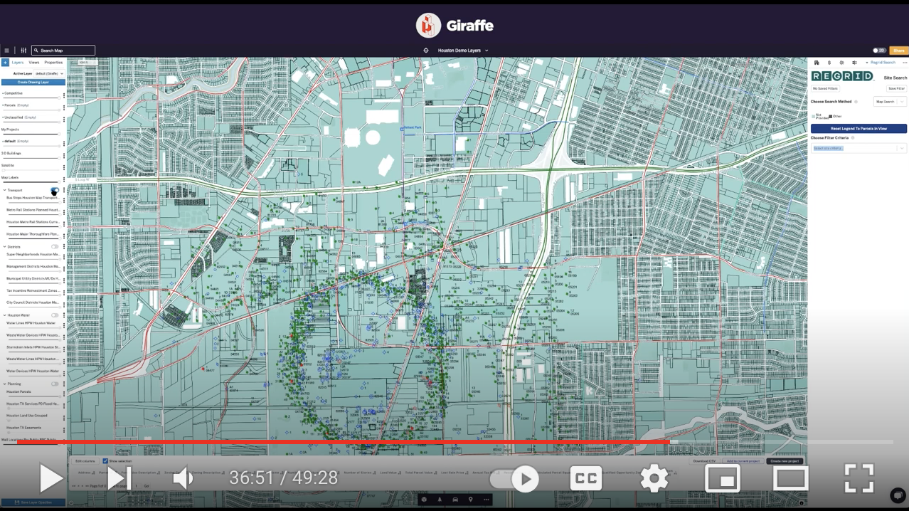
Giraffe launches Site Search powered by Regrid
Site Search is an app powered by Regrid parcel data - making it possible to search by parcel size, owner, zoning, and more to find the exact opportunities you’re looking for. In case you missed their launch, catch their March Product Update Webinar joined by Regrid Chief Product Officer Sahana Murthy.


A thumbnail of the video webcast recording from our talk with Giraffe.


It's been an exciting Q1 here at Regrid. Between launching new products, formalizing Data With Purpose & hiring incredible talent, we’ve been quite busy, to say the least.

Stay tuned for more product updates coming soon.

 
Until next month,
Happy Mapping!
The Regrid Team

Regrid TM


Recent posts on The Regrid Blog:


History of Parcel Data -
All About Parcel Data #2


History of Parcel Data blog post button


California’s pilot project tackles drought using solar panels

California's pilot project tackles drought using solar panels blog post button


Have questions? Want to evaluate our dataset? Get in touch with our team at parcels@regrid.com. 


Learn more about our Nationwide Parcel Data, our schema, pricing and coverage here.

About Regrid

Regrid is an industry-leading property data and location intelligence company. We serve an array of industries that require land parcels and spatial data at scale, including real estate, insurance, energy, infrastructure, agriculture, logistics, and government.

Previous Next
logo

(888) 4RE-GRID

  • Contact Us
  • Customer Support
  • Privacy Policy
  • Terms of Use

Subscribe for email updates

Company

  • About Regrid
  • Careers
  • Press

Resources

  • Coverage Map
  • Support Center
  • Reports

Support

  • Parcel Data FAQs
  • Property App FAQs
  • Contact Support Team

Customers

  • Customer Stories
  • Case Studies
  • Non Profit & Academia

Enterprise Solutions

  • Nationwide Land Parcels
  • Parcel & Tiles API
  • Feature Service

Self-Serve Solutions

  • Regrid Property App
  • Shop the Data Store
  • API Monthly Plans