×
Parcel Data on Demand - Regrid is Esri's Commercial Partner for Parcel Data
Regrid logo, registered trademark
Link
  • Enterprise

    Regrid parcel data Regrid Parcel Data

    Bulk files delivered in the format your business needs.

    • parcel -data United States Parcel Data
    • canada_nav-menu-icon Canada Parcel Data
    • matched building footprints menu icon Matched Building Footprints
    • matched secondary addresses menu icon Matched Secondary Addresses
    • zoning Standardized Zoning
    • enhanced ownership menu icon Enhanced Ownership

    feature service menu icon Regrid Feature Service

    Get data delivery straight into your Esri-stack, no custom integration required.

    regrid api menu icon Regrid API

    Integrate parcel boundaries & records into your app, SaaS, or map.
    • Parcel and Tiles APIcon Parcel & Tiles API
  • Self Serve

    Regrid Property App menu icon Regrid Property App

    Take Regrid property data wherever you go - available for web, iOS, & Android.

    data-store-2 Shop the Data Store

    Instantly download parcel geometries & associated records, by county and state.

    self-serve parcel api menu icon API Monthly Subscriptions

    Sign up and try this nationwide parcel API, free for 7 days.

    api sandbox icon Interactive API Sandbox

    Explore the API Sandbox with complete feature access to 7 counties plus Puerto Rico.
  • Pricing
  • Markets

    agr-con-for_menu-icon-1 Agriculture, Conservation & Forestry

    Regrid for Architecture, Engineering & Construction Architecture, Engineering & Construction

    Esri environments Esri Users

    Regrid for Broadband and Telecommunication Broadband & Telecommunications

    Regrid for Renewable Energy & Utilities Renewable Energy & Utilities

    Regrid for Logistics & Transportation Logistics & Transportation

    Regrid for State & Federal Government State & Federal Government

    Regrid for Insurance & Finance Insurance & Finance

    Regrid for AI & Machine Learning AI & Machine Learning

    Regrid for Real Estate Real Estate

    Regrid for Academia and Research Nonprofit & Academia

    Regrid's Data With Purpose program - propose your own budget to access land parcel data. 

    Plus sign icon Your Business or Organization

    Regrid’s data spans all industries needing land insight.
  • Resources

    support menu icon Support

    Access documentation & support materials to learn about Regrid data.
    • Support site resource icon Support Site
    • tutorial videos resources icon Tutorial Videos
    • parcel data faqs resources icon Parcel Data FAQs
    • property app faqs Property App FAQs
    • coveragemap_resources_icon Coverage Map
    • land use codes menu item Land Use Codes
    • vacancy data menu icon Vacancy Data
    • Data Currency Data Currency FAQs

    content resources menu icon Content

    Dive into Regrid's world of land parcels & learn about location intelligence.
    • blog resources icon Blog
    • webcasts resources icon Webcasts
    • reports resources icon Reports
    • podcast resources icon Living In The Map

    customers resources icon Customers

    Hear what our customers say have to say & see how they use Regrid data.
    • testimonials resources icon Testimonials
    • Case Studies resources icon Case Studies
  • Contact Us

    Contact a parcel data expert menu icon Contact A Parcel Data Expert

    Contact Regrid parcel data experts to learn more about our offerings.

    Customer Support menu icon Customer Support

    Contact our customer support team & get the help you need.

    testimonials_resources_icon-1 Press & Media Inquires

    Find the information you need & get in touch with our marketing department.
  • Go To Map
Go To Map
  • Enterprise

    Regrid Parcel Data

    • United States Parcel Data
    • Canada Parcel Data
    • Matched Building Footprints
    • Matched Secondary Addresses
    • Standardized Zoning
    • Enhanced Ownership

    Regrid Feature Service

    Regrid API

    • Parcel & Tiles API
  • Self Serve

    Regrid Property App

    Shop the Data Store

    API Monthly Subscriptions

    Interactive API Sandbox

  • Pricing
  • Markets

    Agriculture, Conservation & Forestry

    Architecture, Engineering & Construction

    Esri Users

    Broadband & Telecommunications

    Renewable Energy & Utilities

    Logistics & Transportation

    State & Federal Government

    Insurance & Finance

    AI & Machine Learning

    Real Estate

    Nonprofit & Academia

    Your Business or Organization

  • Resources

    Support

    • Support Site
    • Tutorial Videos
    • Parcel Data FAQs
    • Property App FAQs
    • Coverage Map
    • Land Use Codes
    • Vacancy Data
    • Data Currency FAQs

    Content

    • Blog
    • Webcasts
    • Reports
    • Living In The Map

    Customers

    • Testimonials
    • Case Studies
  • Contact Us

    Contact A Parcel Data Expert

    Customer Support

    Press & Media Inquires

    Link

  • Go To Map

The Regrid Blog

Discover the Latest in Land Parcels & Spatial Data with the Regrid Team!

Regrid Blog

Living In The Map

Categories

  • Announcements
  • Democratizing Data
  • Parcel Data Updates
  • Regrid Updates
  • Product How-To
  • Use Cases
  • Customer & Guest Blogs
  • All About Parcel Data
  • Working at Regrid
  • Regrid 100
  • Reports
Crop data layer, parcel centroids, upcoming products, and much more!

Crop data layer, parcel centroids, and more! - August 2021 Newsletter

Team Regrid August 18, 2021

Crop data layer, parcel centroids, and more! This is the Regrid August 2021 Newsletter

We’ve officially been Regrid for a little less than a month and the excitement is continuing to grow. We are overwhelmed with the positive response we’ve received from our community of customers and partners for the new name, site, and design.


If you haven’t checked out the new site yet, please do and give us a shoutout on your social handles - Regrid.com


Same great products, same incredible team - with a new name & a new look!

Well, same great products with new, exciting additions that were just released and some massive updates that are in the hopper. 


Schema Changes - We recently added a host of new fields to our parcel data schema. You asked and we listened!


Here’s a quick glance at the recent additions:

  1. Crop Data Layer Fields (CDL) - Apart from our land use codes, we now have another data point that showcases what is happening on a parcel. The Crop data layer program was created by the USDA to provide acreage estimates to the Agricultural Statistics Board for major commodities and to  digital, crop-specific, categorized geo-referenced output products, using satellite imagery. We’ve used their 2020 nationwide raster dataset to populate crop data value category and acreage on parcels 10 acres large and greater as a part of our premium dataset. You can checkout the fields and their keys here: https://support.regrid.com/articles/cdl-keys/ 


Why is this valuable, you ask?

CDL fields show the land cover type categorized by the various crop types that are being cultivated on these lands, along with their acreage numbers. The cdl_majority_category will list the primary crop (like Alfalfa), and additional technical details are available in the other CDL fields. These fields are especially valuable to our ag and forestry customers, but they have helped inform & improve the accuracy of our standardized land use codes. Just another data point that shows what land is being used for.


You will find these fields in your premium dataset under the following field names as shown in the Regrid Parcel Schema - 


  1. Cdl_raw - This is an array of [value,percentage] pairs that represent the pixel classes present in the parcel and their percentage of the total pixels.
    • Examples: 36, 60.0, 75, 20.0, 87, 10.0, 190, 10.0
  2. Cdl_majority_category - This is the human readable Category name for the land cover type that is most common on the parcel.
    • Examples: Alfalfa
  3. Cdl_majority_percentage - This is the actual percentage of pixels for the majority category.
    • Examples: 60.0
  4. Cdl_date - The year of the Cropland Data Layer data set the current attributes are derived from.
    • Examples: 2020


2. Latitude & longitude have been added as separate fields to our schema. While our data has always included the full parcel geometry and our platform has listed the parcel centroid, we recently added latitude and longitude as independent fields across all data formats and deliverables. These fields are available now to Pro users and will be rolling out to data customers this month. 


3. Taxyear - A county-provided date that indicates which tax year the assessor's attributes apply to. We are starting to roll this out across our dataset.  


That’s a wrap on recent additions to the data. 

Here’s a look at our upcoming product updates:

  1. Parcel API - We are adding the ability to search our API by a polygon (geoJSON as an input) soon. Currently, our API is searchable by APN, lat/lon, address and owner name. You asked for ‘search by polygon’ and we will get that out to you shortly. 
  2. Matched building footprints - We are working our way through the private beta of our pre-joined building footprints dataset. So stay tuned for a launch announcement coming up shortly.


If you're interested to learn more about our upcoming products and buildings data, please contact us at parcels@regrid.com.


It’s been a busy summer at the Regrid HQ. :)

We’ll be back with more announcements soon.


HAPPY MAPPING!
Team Regrid
team@regrid.com

Regrid Logo


Upcoming Events:

September 23rd @ 1:00PM EDT
Catch our team on a virtual event with Geoawesomeness.
AI Needs Data Normalization: Dealing with disparate public data at scale.


Geoawesomeness-logo-500px

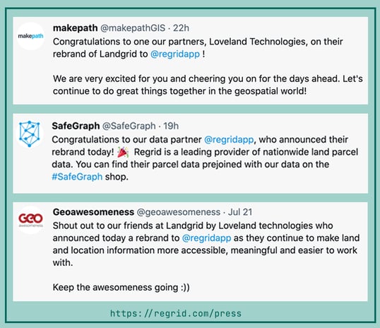
Support from our wonderful partners:

Testimonials from makepath, safegraph and geoawesomeness


Interested in our products? Reach out to our sales team! Click here to contact us.


Previous Next
logo

(888) 4RE-GRID

  • Contact Us
  • Customer Support
  • Privacy Policy
  • Terms of Use

Subscribe for email updates

Company

  • About Regrid
  • Careers
  • Press

Resources

  • Coverage Map
  • Support Center
  • Reports

Support

  • Parcel Data FAQs
  • Property App FAQs
  • Contact Support Team

Customers

  • Customer Stories
  • Case Studies
  • Non Profit & Academia

Enterprise Solutions

  • Nationwide Land Parcels
  • Parcel & Tiles API
  • Feature Service

Self-Serve Solutions

  • Regrid Property App
  • Shop the Data Store
  • API Monthly Plans